You're already more engaged than
80% of your website visitors.
Imagine if your readers felt this way.
The engagement crisis
AI tools are flooding the web with generic text content. Average session times are collapsing. But interactive maps? They create an experience that no AI can auto-generate — and your readers can feel the difference.
Maps demand interaction. They invite exploration. They turn a passive reader into an active participant — and that participation is what advertisers pay a premium for.
AI-generated articles are driving CPMs down. Content farms now produce thousands of identical posts. Your only defence is interactivity.
A custom map embedded on your site can't be scraped, replicated, or outranked by a generic AI summary. It's uniquely yours.
Longer sessions, more pageviews, lower bounce rates — every metric that drives ad RPM improves when readers have something to click.
A page with an embedded interactive map signals to Google that you have real, useful content. That translates to rankings text alone can't achieve.
A useful interactive map is a tool, not just an article. Other sites link to tools. Bloggers share tools. A great map becomes a backlink magnet that keeps earning long after you publish it.
Don't write an article explaining how to find the answer. Build a map tool that gives them the answer directly. Click a trail, get the elevation. Click a country, get the data. Your site becomes the destination, not a stepping stone to one.
Show a migration route unfolding. A city changing decade by decade. A journey from start to finish. Maps turn information into something readers experience rather than just absorb — and that's what they remember and share.
Everyone knows unique data earns links. But a spreadsheet gets skipped. The same data on an interactive map gets shared, embedded, and cited by journalists and other bloggers. The map is what makes your research newsworthy.
From Daniel's own experience growing Mapscaping and across client sites.
What you get
Every map is hand-crafted for your niche, your audience, and your CMS. No bloated plugins, no monthly fees, no vendor lock-in.
Fully interactive, mobile-responsive maps tailored to your content — travel routes, trail guides, location finders, data layers. Whatever your niche needs.
Map-powered location pages that rank for "best [activity] in [place]" keywords. Each page includes a unique embedded map and structured content.
I source and integrate open public datasets — elevation, trails, points of interest, administrative boundaries — so your maps are data-rich from day one.
Pure client-side Leaflet.js. No server to maintain, no database to manage. Your map lives as a fast, simple HTML/JS file embedded anywhere on your site.
Built on open-source tools (Leaflet) and open tile layers (CartoDB, OSM). No MapBox fees, no Google Maps billing surprises — ever.
Maps styled to match your brand and audience. Travel bloggers, outdoor sites, local businesses, real estate — each gets a map that feels native to their world.
The process
Fill out the short form below. Tell me your niche, your audience, and what you'd love a map to do for your readers. No brief is too rough.
I design, code, and test your custom map. I'll handle data sourcing, styling, and embedding. You get a drop-in snippet ready for your CMS.
Your readers explore, click, and stay longer. Your session time goes up, bounce rate drops, and your ad revenue follows. Then we talk about what's next.
Real work
These aren't mockups — they're live tools with real audiences. Click through to visit them.
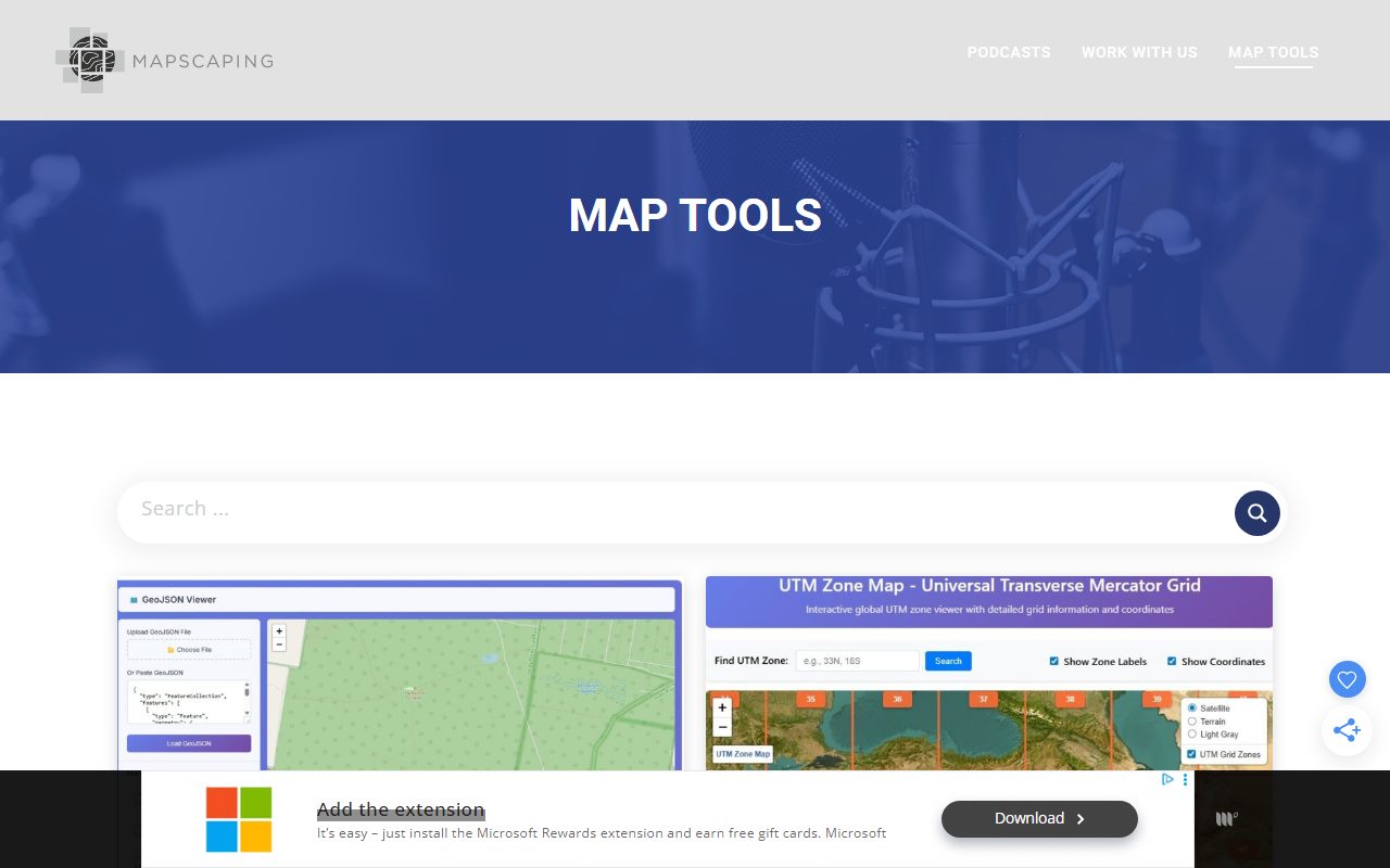
A growing library of free, browser-based map tools for the geospatial community — GeoJSON viewers, UTM zone maps, coordinate utilities and more. Built to give the Mapscaping audience something they can actually use, not just read about.
Map Tools Leaflet Open Data
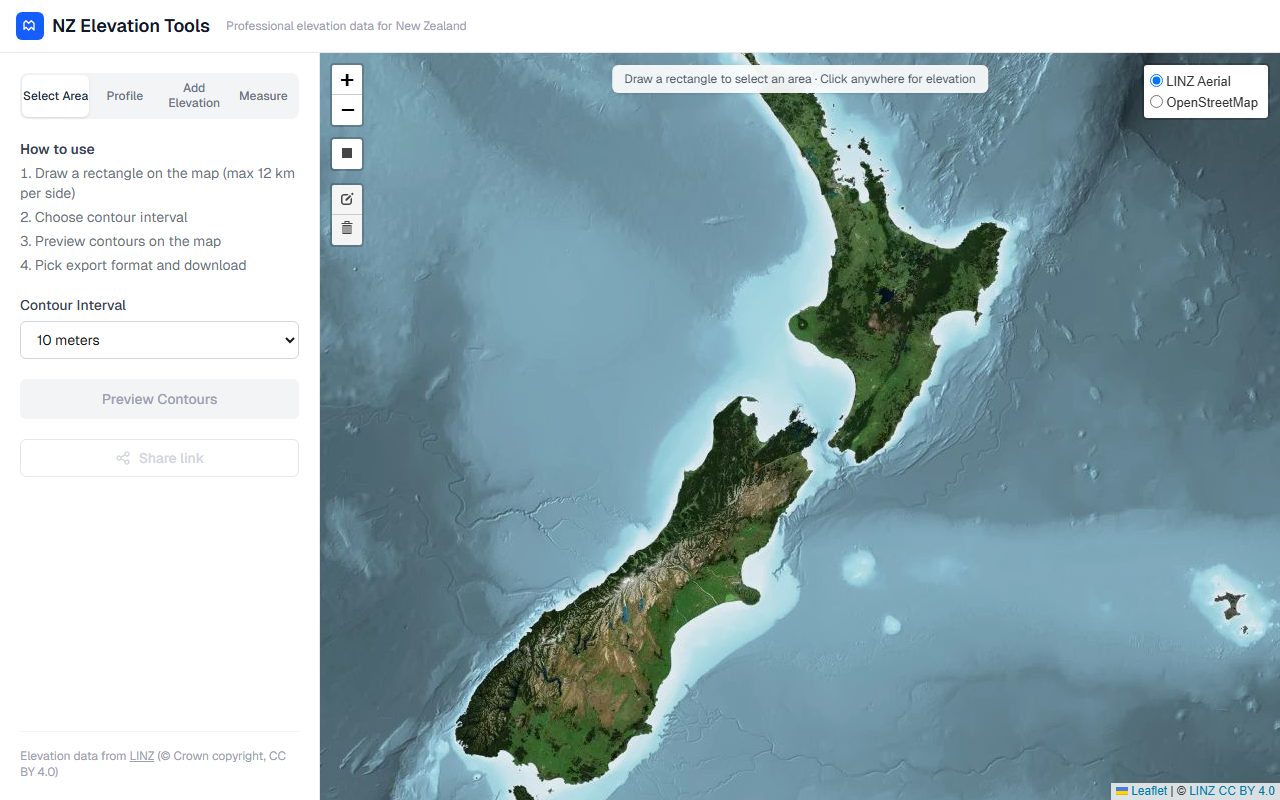
Draw any area on a satellite map of New Zealand and instantly generate contour data from LINZ elevation sources. Choose your contour interval, preview on the map, and download in your preferred format. A genuine tool people return to before every trip.
Elevation Data Leaflet LINZ Open Data
Browser-based GIS tools that run entirely client-side — no uploads, no servers, complete privacy. EPSG coordinate transforms, batch coordinate conversion, Lat/Long to UTM and back. The kind of tools professionals bookmark and return to daily.
GIS Tools Coordinate Conversion No BackendGet started
Tell me a bit about your site and what you're hoping to achieve. I'll get back to you within 24 hours with ideas.
After you send this form, I'll review your site and reply with a few thoughts on what kind of map could work best for your audience — before any commitment.